Thursday, October 9, 2008

Wingdams and Weirdams October 9, 2008


Hoppie's Marine Service is the only place to get gasoline for the next 250 miles and the only marina for the next 228 miles! Hoppie's is made up of three 100 foot long barges tied into a high stone wall. Luxurious it is not but functional it is! Fern Hopkins (husband Hoppie) gathered everyone around her barge table and gave us the latest river information.


The first piece of information we checked out was the Blue Owl. Please take a look at the merchandise and drool!


Before starting down the River members (Woody, Ellen, Tom, Barb and Ken) debate politics and decide on today's stopping place. We decide on Mile 117.5 at Kaskaskis Lock - 42 mile.
We are the last to leave but then have to return to get Debbie's Camera. Tom is not happy about this and even less happy when he forgets he was raising the port motor when Debbie remembered the missing camera. At the dock he puts the motor in reverse and wraps a cord around the port propeller. At least an hour later and one swim under the boat, we are ready to leave. Then we notice that the starboard motor was not turned off and was out of the water. Not a good plan. Tom decides this is a very bad day. He did not use those words ---


One of the things Fern explained to us was Wingdams. These a stone walls or groins along both banks running perpendicular to the river. They deflect the river current toward the center of the river. Safe anchorages can be found behind these wingdams but boats must be very carefully that they don't enter too shallow an area or get hung up on a shoal (shallow sand bar). Note the sand shoal in the middle of this wingdam.


Weirdams or Bendweirs are rock sills (lines of rocks under water) located in navigations channels of a bend usually 20-30 degrees into the flow of the river, 400-1,600 feet in length and 400-1,400 feet apart. Normal traffic usually passes over them but not in low water. The purpose is to control the flow of water through a bend, at least that is the Corps of Engineers reasoning. Fern says they are not working. What they do is cause major swirls and making steering through them a major chore. Fern advised us to radio upriver barges to see if they are entering the bend and if so, wait. If not, pass on the inside of the curve (or the up riverboat's path) as far away from the bendweirs as possible. Fern gave us the location of some of the most dangerous bendweirs and we passed through the Mile 13o one today. Sorry no underwater pictures!


Along the way we saw limestone walls, quarries and a house that looked like a castle.


We turned left a few hundred feet into the Kaskaskia River at mile 117. Tom called the lockmaster on Channel 14 and got permission for us to tie on the lock wall. Ken, Ellen, Woody and John came down the wall to catch our lines. Barb and Brenda were further down the Wall. With one motor we were happy to have all the help available. Today we had been averaging 9+miles an hour on one motor with the help of the current. However, it is much easier to steer in narrow areas or when docking with two motors which we no longer have. One interesting fact about this lock wall is that it is a floating wall. The Lock and Dam don't float and can be underwater in flood times.


We had our five o'clock meeting on the lock wall. It will be nice to be a short distance from the main river and much quieter away from barges, trains and cars.




Wednesday, October 8, 2008

The Big City October 8, 2008


From Yesterday:
Alton Marina is a very nice facility. They have A-J covered docks. The last few spots are open to the sky for sailboats.


A view inside a dock at Alton Marina.


Here is a picture of a sliding ring at the water level of each piling of the floating dock.


They also have a casino next door and a large pool with two hot tubs!


By dinner time we had four of our group in residence. Cynthia Faye, Baby Grand, Rose's Pick and us. Debbie was wondering what had happened to Rose and Gary since we last saw them in Joliet. They report that a barge turned sidewise in the River below Joliet and they had to wait a day for it to be cleared.


After dark the gleaming suspension Clark Bridge appeared over our heads!


The above pictures got added a day late because of the debate. We ended the day with a beautiful sunset, the first sun we had seen all day!


Wednesday we untied Catrina and hit the river at 7:30. We had gone through two locks, a canal and passed St. Louis by 10:30.


Because these locks are so heavily used, they have two chambers. The pleasure boats use the small one on the left. What a great idea. No long wait for all the barges to use the lock first! The Mel Price lock is where 30 percent of the world's grain passes over each year. With all the farm lands up river being under water, we hope the crops have been harvested already.


Five miles below the Mel Price Lock is the Missouri River junction. The current and turbulence increases.


The Chain of Rocks Lock starts with a canal, oddly enough called the Chain of Rocks Canal necesitated by low water dam in the Mississippi at this point that is not passable.


When the Canal emptied into the Mississippi ten miles downstream, we get our swiftest current of the trip. We were going close to 10 miles an hour on one engine. The current twisted the bow back and forth. We took the boat off automatic pilot and went on Debbie or Tom pilot!


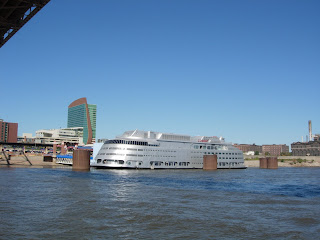
There must have been a few hundred parked barges and consider-able industry along the river through St. Louis except where the Arch is located. We also saw signs for the Riverfront Bike Route, the same one we had noticed along the Chain of Rocks Canal, and a silver casino!


Also we could see the erosion caused by high water.


One last question: How many bridges do you see?


Hoppie's Marine Service, 45 miles south in Kimmswick MO, is our location tonight. Tune in tomorrow to find out why Hoppie's is such an important marina.


Bridge Answer: 4


Tuesday, October 7, 2008

RAIN AND FOG October 7, 2008


About 3 a.m. we heard rain drops on our roof. When we dragged ourselves out of bed, it was still grey and humid with scattered light showers. Not a great day for photos or people although great for ducks!


The Grafton Marina lent us a car and gave us directions to the propane business. Yesterday as we cruised along, our refrigerator stopped working. Both small propane tanks were empty - no stove and no refrigerator! It is not that easy to find a facility that will fill our tanks (versus exchange) so this was a happy solution and very timely! When we are in port, we change over to electric on the refrigerator but not on the stove.


Another interesting feature is the way marinas are built in this district. Before, most docks were fixed. As we traveled south more of the docks became floating. Grafton yesterday and Alton today had both floating docks and buildings. When the river rises, so do all floating marinas. Look for tall pillars with ring attachments.

Tom chats with Peggy and Bob from Baby Grand about today's plan. It was decided that we would follow them to Alton. They have good radar and ours is stored under our bed!


As we venture out on this foggy day, we dodge a ferry that runs from Grafton to Missouri.


The flat fields (often under water) change to high bluffs after the conver- gence of the Mississippi and Illinois Rivers. Highway 100 which joined us above Grafton is know as the Great River Road. "Major fleeting areas (barges) and numerous grain elevators are clues that this part of the river is an active and major port". The lock just below Alton has 30 per cent of the world's grain pass over it. We will pass it tomorrow. The rest of this day is down time, dinner aboard and the debate!

Monday, October 6, 2008

RIVER CREATURES October 6, 2008

Catrina was on the river when the sun came over the bushes. We had an 88 mile day planned and wanted to reach Grafton, the last town in IL, before dark. Half the day we ran on one motor. Then Tom became bored and started up the other one. We cruised along at 10 mph and reached Grafton by 4:30.


We dodged River Creatures all day long. Most very small and some bigger than this one.


Look out this front door at the front lawn!


This Eagle circled our boat and dove for a fish.


Ten miles down river was our last Lock on the Illinois River. As we approached, we started looking for the dam and lock. On the right were the structures at the missing lock and on the left was the non-existent Dam. Both were deeply underwater so that the Lockmaster told us to go right over the dam or rather go down the left side!


Some of the interesting things that we viewed along the Illinois were :


A beautiful sailboat ??? headed for the Mediterrranean


A Houseboat heading up river


A Waterline just under the windows on a house


A New Orleans bound Raft containing University of Chicago Graduate Students


A Railroad Bridge with a house in the middle and another on the side. Where is the control room?


At Grafton, the Illinois River joins the Mississippi River. The flood warning on the Illinois has not reached this point and the Mississippi River is at normal level. We had hoped the current would be strong here. Tomorrow we may find out!


Home Sweet Home tonight is the Grafton Marina.

Sunday, October 5, 2008

Sunday - A Day of Rest? October 5, 2008

The alarm went off at 6:45a.m. but we were already up and ready to get gas and give brown water back. Today we only traveled 32 miles to Beardstown Town Dock where we tied up to a cement filled barge. We motored down the river on one motor again and made almost 8 miles per hour.


Remember the statement that the Water Level had dropped. Here is a picture of how high it was. When it gets back to normal, the river edges may not be pretty.


Some people were very smart and built their houses on stilts!


As we neared Beardstown, we were passed by Bank Grand, a boat our length but with very different features.


We tied up about 12:30 on the barge wall. Joy@sea and Barbara were already there. They caught Baby Grand's and Catrina's mooring lines. Soon Cynthia Faye joined the group. and we completely filled the dock. The town had replaced the walkway from the barge to the land that the flood had washed away. It made it easy for us to explore.


Debbie took off for Walmart on her four miles per hour shoes. In an hour she was back with two more 5 gallon fuel cans. We had figured the miles without gas available on the Mississippi-Ohio-Tennessee Rivers and decided to play it safe!


On the way back she met Barbara, Ken and Peggy. Barbara suggested a progessive dinner party. Peggy said she was going to the Laundry. Debbie hoped Tom had thought of all the dirty clothes but when arriving home, he hadn't so she did. Peggy and Debbie found a Dairy Queen directly across from the laundry. A Reward! Barbara and Ken lent us their cart. Laundry can be very heavy when you each have two full bags!


This is Baby Grand's cockpit!


Everyone brought an item or two to the picnic table and we had a delicious feast. That Barbara , the lady, is a good party planner!


Saturday, October 4, 2008

Lost Lock October 4, 2008

Looking back under the bridge, we wished Peoria goodbye!


Catrina had a late start from Peoria Docks. Five miles down was the Peoria Lock and Dam. Tom called ahead and learned that we could go over the dam. What no lock? The waters were higher than the dam so the dam was lowered and down the river we went. It was like the dam was not there! Sorry, guys, no picture!


South of the Lock that wasn't was a 35 mile stretch with no marinas or anchorages. Now we find out that it is recommended that we start early in the day so that we can make it to the next facilities before dark. We goofed on the leave early part and with the high water/swift current, we really did not have to worry about a slow trip. Tom pulled one motor up and we chugged along at 5 mph plus 2 for current and averaged 7-8 mph without the second motor. Some of the things we passed along the way were:


Little Tug Boats from Holland MI.


The Corp of Eng resetting markers.


A Green Marker hidden under a log.


Many Markers were just missing!


The beginning of color along the shore.


Cottages along the shore.


And last but not least we got passed by two of our friends Joy@Sea and Barbara and haven't seen them since!


About 3 p.m. we arrived at the Tall Timbers Marina a few miles above Havana. We needed to stop and get gas. Cynthia Faye and Catrina found Baby Grand whom we last saw at Joliet. The Marina was closed but the owner promised to arrive at 7 a.m. and pump gas! It was an easy decision to spend the night rather than head for the next mooring 30 miles down. We could see how high the water was in this Marina. We estimated that the water levels had dropped about 6 feet but were still 4-8 feet above normal. The owner said waters were still 11 feet over normal! Floating docks were a great invention.


The group of six loopers was joined by a new looper from Burnham just above Chicago. We had a 5 p.m. get together on the dock with lots of nats flying about, a warm shower and dinner aboard!