Alton Marina is a very nice facility. They have A-J covered docks. The last few spots are open to the sky for sailboats.
A view inside a dock at Alton Marina.
They also have a casino next door and a large pool with two hot tubs!
By dinner time we had four of our group in residence. Cynthia Faye, Baby Grand, Rose's Pick and us. Debbie was wondering what had happened to Rose and Gary since we last saw them in Joliet. They report that a barge turned sidewise in the River below Joliet and they had to wait a day for it to be cleared.

After dark the gleaming suspension Clark Bridge appeared over our heads!
The above pictures got added a day late because of the debate. We ended the day with a beautiful sunset, the first sun we had seen all day!
Wednesday we untied Catrina and hit the river at 7:30. We had gone through two locks, a canal and passed St. Louis by 10:30.
Because these locks are so heavily used, they have two chambers. The pleasure boats use the small one on the left. What a great idea. No long wait for all the barges to use the lock first! The Mel Price lock is where 30 percent of the world's grain passes over each year. With all the farm lands up river being under water, we hope the crops have been harvested already.
Five miles below the Mel Price Lock is the Missouri River junction. The current and turbulence increases.
The Chain of Rocks Lock starts with a canal, oddly enough called the Chain of Rocks Canal necesitated by low water dam in the Mississippi at this point that is not passable.
When the Canal emptied into the Mississippi ten miles downstream, we get our swiftest current of the trip. We were going close to 10 miles an hour on one engine. The current twisted the bow back and forth. We took the boat off automatic pilot and went on Debbie or Tom pilot!
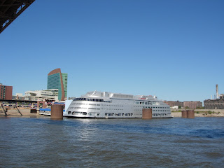
There must have been a few hundred parked barges and consider-able industry along the river through St. Louis except where the Arch is located. We also saw signs for the Riverfront Bike Route, the same one we had noticed along the Chain of Rocks Canal, and a silver casino!
Also we could see the erosion caused by high water.
One last question: How many bridges do you see?
Hoppie's Marine Service, 45 miles south in Kimmswick MO, is our location tonight. Tune in tomorrow to find out why Hoppie's is such an important marina.
Bridge Answer: 4


