With no heat at our water hideaway (Bashi Creek), Debbie nearly froze. We went to bed early with extra covers and tried not to get up during the night. When the alarm went off at 6:30, it was 48 degrees in the cabin. It was very hard to take off our hats, mittens and everything else to get into day clothes. You guessed it. We dressed in record time and were on the river by 6:45 a.m. The sun was just coming up over the trees and the fog was disappearing. It would be a sunny day!

We are determined to get to Three Rivers Lake because then we can be in Mobile by Friday night. However, that is 81 miles and one lock away. When we had been on the river about an hour, some of the boats from Bashi come up behind us.

We cannot understand why they are not passing us until they turn off at Bobby’s Fish Camp (Mile 118.90 ). We hear the Bashi boats talking on the radio and discover all six boats are stopping at Bobby’s for the night. Bobby’s has a 100 foot dock which is filled on a first come, first served basis. There is no electric service but they do charge by the foot. There is a restaurant which is open for dinners Thursday through Saturday and if our digital clock which tells us correctly, this is Thursday!

Two miles down at Mile 116.6 is our last lock and dam, Coffeeville. Tom calls and we are told to that as soon as he fills the lock we can drive right in. Ten minutes later Debbie lassos a bollard and soon we have gone through our last lock of this trip

Coffeeville Dam is letting water out.

At mile 103 we pass Peavy’s Landing or as the locals know it “Redneck Rivera”.

We move into mileage double digit numbers about noon. They are so much easier to read on the shore signs and it means we will be Mobile for the weekend. Tom is able to get on his cell phone and makes a reservation at Eastern Shore Marina just east of Mobile for three nights with mast raising on Monday. We hope it is much warmer there. Days are in the 70’s but when the sun goes down, it is a bit nippy for us Floridians!

We pass a few barges today about one every 20 miles but they are the only boats on the river. We have lost those terrible hairpin corkscrew curves of yesterday and it is a long but relatively easy day. Below is an interesting home predicament!

At of the Coffeeville Dam we entered the tidal waters and are at sea level. We have tides! Bridge heights are referenced to the mean high water (MHW) while anchorage depths are to mean low water (MLW). We have to be careful when we select a overnight mooring that we will not become aground at low tide! We are seeing frequent water level measuring post.

Late afternoon a coast guard boat passes us.

We know we are getting closer to civilization because we now have a few bridges over the river. It is 85 in the cockpit this afternoon and when passing under a bridge, Debbie get dripped on through the skylight.

Unfortunately, we spoke to soon about the pleasant relaxed curves. We end the day with a curlique route. We are happy our route is not measured by “as the crow flies.”

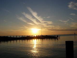
After the sun sets we get to our mooring at Three Rivers Lake at 5 pm. We don’t see a lake or any rivers other than the Black Warrior we turned off. We did 81 miles (definitely the longest day to date) in 10 ¾ hours!!!


 We pass a swinging railroad bridge. This time we did not have to ask. They saw us coming and open the bridge!


