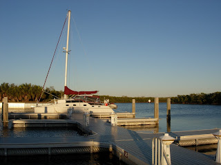
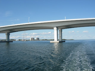
Wednesday, February 4, 2009

CALADESI TO SANTA MARIA February 4, 2009

What a good night's sleep! Finally at 10 am we left our hideaway for the Inland Waterway. The wind was still howling but the sun was bright and the water was choppy with 14-16 mph winds. A Great Day!
At Clearwater we ventured out into the Gulf. I wasn't sure we would make it out because the waves were coming right at us and they were big! We turned south and enjoyed the waves, wind and speed. Here is a picture out our stern.


Since this is also a fishing trip, Tom made a fishing cleaning station which he attached to the stern railing.


Nobody was out on the water today. We did not see a single boat until almost 1 pm when Debbie sporatically saw four stacks above the waves. She called Tom out to look. It was decided it was the top of a freighter and it did not seem to be moving. As we approached the Tampa Shipping Channel a boat did emerge above the waves through our front window.


The drops on the glass are from waves but it is defiinitely a freighter.


As we drew closer, Debbie took a picture through the side window. Sorry, I bet you did not want to see our screened window!


The freighter was at anchor just outside the shippng channel. Because it was so big we could see it for miles as we rode up and down over the waves.

It is a lot of work putting sails up and down and adjusting lines in 15-24 mph winds. Whenever possible, we did it from inside. If we had to go outside, a life preserver was standard attire. The autopilot worked well until the waves go to four or five feet in height. At that point we stopped monitoring and took the wheel. Tonight we are saying "good job" with a shoulder/back massage for the other person. It is amazing how many muscles get used just staying upright much less steering on a very toss-ee-turv-ee boat!


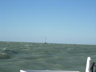
At the northside of Santa Maria Island a black hulled sailboat appeared near shore. Tom was at the helm and he decided the other boat was racing us. As they moved farther off shore and we worked our way toward Longboat Key Bridge (Passage to ICW), we upheld the honor of the catamarans by passing in front of them. Poor Monohull!

About 50 miles and 7 hours later we called the bridgemaster at Longboat Key. He said he has been watching us as we headed into the wind and dropped sail. Tom had to start both motors to keep Catrina into the wind so Debbie could quickly go up on deck and lower the main. As promised, the bridgemaster raised the bridge just in time for us to pass through. It is not easy to stay in the narrow channel and zigzag waiting for a bridge to be raised. We gave him a big wave of "thank you"!


In route Debbie had called cousin Wally for Pete and Nancy's phone number. Wally and Helene were in a museum in New Orleans but came up with the number without being kicked out off the tour! Pete and Nancy couldn't join us for dinner but did give us a suggestion of a good spot to drop anchor and that is where we are tonight. Out our windows are sparkling house lights along the ICW and the water is gently rocking Catrina as the wind continues to whistle around us. We turned on our water heater and Oh Boy! did that shower feel good on our sore muscles!


pic 82

Tuesday, February 3, 2009

EARLY, WINDY & COLD February 3, 2009

After days of preparing, we finally removed our mooring lines and left our canal at 6 a.m. Perhaps starting before first light on a cold windy time is not a good omen. We managed to find all the markers and not go aground in the Crystal River. By the time we reached Shell Island at the Gulf Coast, we could see the trees and read our wind meter - 24 knots. Wow! Here we go!


Catrina flew along at 9-12 mph for a few hours as we dodged crab trap buoys. Crabbers were busy removing the traps as the Blue Crab season is over. We dodged them also. Before we reached Tarpon Springs the wind had dropped, waves were up to 2 feet, the wind was abeam (we rolled alot on the waves) and we had hooked two crab traps. Tom removed both, one with our boat hook and the other with a fish knife. No one fell off the boat. It was great to be sailing with both sails up and no motor!


About 1 p.m. we approached Tarpon Springs and headed for Caladesi Island State Park, located 4 miles north of Clearwater. Loopers Ted and Sarah aboard Manatee stayed there a few days ago and we decided to take their recommendation. Occasionally, waves were 3 feet high which really rolled our boat. We left the Gulf for the Inland Waterway ICW and more gentle seas. The Dunedin Causeway Bridge saw us 3 miles away and acknowleged that when the Catamaran got to the bridge it would be up! That's about when the Port Jack got wrapped around the side stay and the battons in the main got stuck on the stay. We passed under the raised bridge with the main half up or down depending on which side you were on. Debbie was hiding behind the sail!

Never put the sail down even if the Captain tells you to when you are NOT headed into the wind!


After reading the directions of how to find the secluded Island Park at least a mile off the ICW in three different sources, we ventured into the heart of the Island along narrow, shallow, winding channels. Our depth finder read 4 feet most of the time. It was high tide. That means it was beeping continuously. After a few questionnable turns, we found the Marina. We became the fourth boat in residence tonight. A larger sailboat than Catrina caught our lines and pointed out the features of this State Park: 108-slip marina, kayaking on the 3 mile mangrove trail, sunbathing, swimming and collecting shells on the pristine white sandy gulf beach, hiking on the nature trail (watch out for rattlesnakes), fishing, birding, as well as a picnic area, children's playground and Cafe Caladesi (not open). As Florida Senior Citizens it cost us $10! That's one third of our previous lowest overnight rate!


After 11 hours (65 miles) in Catrina, we decided to explore the island before a well earned dinner of beef stew, salad and Jimmy and Sue's oranges for dessert. The wind howled outside our water home as we caught up on e-mails, watched TV and snuggled in for a cold night in our secluded island hideway. We promised each other to bring our kayaks next time and explore the mangroves!

Thursday, January 22, 2009

Bimini Re-sewn January 20, 2009


Sunday the Bimini (Cockpit Cover) was returned with all new stitching and four new windows. The Zipper around the stern door slides up and down easily. When we look out our four new windows, we wonder why we did not do all of them. They are so clear that we can see quite a contrast with the fourteen year old ones. Looks like we have a project for another year. A nice feature of this cover is that it comes in sections. That makes it very easy to repair, to remove or roll up for full air circulation on hot days. Unfotunately, it has been in the 30's to 50's most days for the last two weeks. This morning there was a layer of ice on the Bimini! Where is WARM and Sunny Florida?


We have been asked where we dock the boat. We live on a 45 house canal half way up a Gulf River. Catrina is located about 30 feet off our back porch. We can look out from the living room or master suite and check on her at any time. We have solar lights along the dock and hook ups. She is almost as tall as the Cupola and can give us extra guest accommodations or a way to explore the river or gulf.

Sunday, January 11, 2009

SAILING SCHEDULE January 11, 2009


Catrina along with Tom and Debbie are in canal-dock in Crystal River for December and January 2009. We have been busy washing the Mississippi Mud off Catrina and applying a coat of polish. She is white again with a new black salt water paint bottom and starboard rudder courtesy of Old Tarpon Marina in Tarpon Springs. In the next week or so we will get the starboard motor back from the yamaha repair shop and the bimini from steamstress. Tom has changed the electric intake to the front of the boat, added outlets, surge protectors, lights and storage areas. He also changed the location of the GPS and Compass and built a storage shelf under the captain's feet. He is a very creative, good workman.

Fresh Water Bottom

February and March we plan to sail south to the Keys, enjoy the warm sunshine, beautiful blue waters, snorkel and fish. Friends are welcome to join us and can contact us by e-mail or cell phone. We hope to cross paths with our looper friends.

Salt Water Bottom

Saturday, November 29, 2008

GULF AND CRYSTAL RIVER November 29, 2008

With Catrina all gassed up and tied down, we decided to take advantage of the good weather to cross the Gulf to Crystal River, Home Sweet Home! This is Friday afternoon and Saturday evening the bad weather should arrive and stay though Monday. Who needs sleep? Cast Off and Away!
Catrina passes under the 98 Bridge, our last bridge, and heads out into Apalachicola Bay at 4:30 p.m. on Friday. While we were getting gas we realized we should have switched from Central to EST. Did anyone wonder why it took us 1 ¾ hours to get gas?

Tom has mapped out our route and put it on the GPS and on his Computer MacEnc program. MacEnc consists of all the NOAA Charts of the US. He has a “cheap” GPS attached to his MAC which adds our position and tracks our movement over the seas. It is a complete navigation program and definitely the 21st century way to go!


Apalachicola Bay is an 8 mile stretch between the town and St. George Island, a thin coastal island. We follow a markered path because the first 5 miles is anywhere from 2 to 5 foot deep and the rest is 10-12 feet. Catrina passes through Government Cut into the Gulf into 15 mph winds. Up go the sails. We move along at 7 mph with two sails and one motor. Our route from Government Cut is a straight shot of 115 miles at 116 degrees to Sea Horse Reef (west of Crystal River), about 30 miles to AIA (the outer marker into Crystal River) and then 7 miles up the River to our Canal. As we sail along the waves and wind increase to 20 mph. We clip along at 9+ mph until 3 a.m. when it starts to drop. Waves hit the starboard bow and splash over the front of the boat. We are on a SW course and the wind is 60 degrees off our starboard bow. That makes it a “tight reach”.

We view another fantastic sunset and watch it dip behind the horizon!


It is totally dark by 6 pm EST and for the next 12 hours. Being away from city lights, we have a million stars to pick from. There are also airplanes, satellites, venus and a few lighted markers. Tom points out the glow in the sky from Tallahassee to the NE and Tampa to the S.
We passed a total of 5 boats. Tom and Debbie take turns on watch. Since we are not paid for this job, it is a volunteer position. When on watch, we check to see that Catrina is following the charted 116 degree course. As the wind increases, the autopilot must be adjusted to keep us on course. Then at 3 a.m. when the wind begins to drop, it must be adjusted back the other way. Another important duty is to periodically look out all windows not just the front ones. We did see five other boats and we had to decide from a distance if they were lighted markers or actual boats. The charts help a lot on find the markers. The red/green lights at the front of the boats helps with direction but is usually not visible until the boat is closer. Catrina being a sailboat has a 50 foot high white light and green/red on the bow and white on the stern. We also have a steaming light halfway of the mast. When approaching another boat or checking for luffs, we put it on. It lights of the sails and makes it easier for everyone not to run into us!

Another way to stay awake is to make and consume food. Debbie made dinner during the afternoon and microwaved it for dinner. We ate a variety of sandwiches and snack bars and our last two apples while on watch. When the eastern sky started to glow, Debbie made oatmeal. She was getting up and Tom was going to bed!

These are not raindrops but drops from waves splashing up on the windows blocking our view of the sunrise!

This was really a very easy, pleasant trip across the Gulf. Before we left Tom called both his son Mark and neighbor Jimmy with our plans. If we do not show up at Crystal River by 5 pm Saturday Jimmy will call the Coast Guard. That’s what friends are for besides all the following things: hauling us places, storing our truck-camper-Macgregor, selling our extra car, adjusting the irrigation system at Debbie’s home, finding Catrina a Marina on Kentucky Lake, watching our homes for six months, collecting our mail, taking our sick outboard motor to be repaired, picking it up and reinstalling it, teaching us how to go through locks, giving us a home for two weeks when Tom had knee surgery, finding a hair salon and chiropractor for Debbie and an Orthopedic doctor for Tom. The list goes on and on and we really appreciate all this special attention. We cannot thank each of you enough.


We have made many new friends and hope to continue these relationships. And most of all we thank our families for understanding that not everyone lives a conventional lifestyle. Some of us are just different and like to change plans on the spur of the moment. But we do keep coming back!

Now for some statistics. We have been away from Crystal River from Mid April to the end of November. During this time we have lived aboard Catrina for 54 days and spent 43 days traveling aboard her. We have covered 2,415 miles from East Tawas MI on Lake Huron to Crystal River FL on the Gulf. Between September 2nd when we moved aboard Catrina to November 29th when we reached home, we have taken time off in MI, IN, KY and FL for 36 days.
We pass Shell Island as we enter the Crystal River and return to our Florida Home! The End.

APALACHICOLA November 28, 2008

After a pleasant night we got up at 7:15 and found it lightly raining. We grabbed our rain jackets and pulled the anchors. If you have wondered how we get two anchors out equally on each end of Catrina, it takes a little team work. First we drop the Bow anchor and let all 225 feet of line out. Second we drop the Stern anchor and let out half of the distance used on the front line as the front person pulls in that much line. And there you are halfway between!


When you pull the anchor out, it is reverse. First you let out all of the bow line which should take the boat back to the Stern anchor. Tom pull sup the Stern Anchor and then motors the boat forward and Debbie pulls in the Bow line. and anchor. However, today she got within 15 feet of the anchor and nothing would budge. Tom drove forward to try to dislodge the anchor which helped a little but it still was stuck. Then Tom muscled the anchor loose and we swished it around in the water to get off all the mud that had held it so tightly! And that is how we got off at 7:45 a.m. in the rain!


We motored along the last 7 miles of East Bay, entered Wetappo Creek for three miles and then took the south prong of the Wetappo Creek, all of which was also called the ICW.


We passed groups of homes along inlets and ox bows.


There are lots of Eagles along this section of the ICW .


We can see activity in a nest.


Twelve miles later we passed the cutoff for Gulf County Canal, a man made passage to the Gulf. We counted 8 fishing boats. Either there are a lot of retired folks around here or everyone took a long Thanksgiving weekend!


We pass a shrimp boat close the Gulf Canal.

The next 8 miles of the ICW are Searcy Creek. Here we can see many ox bows that straighten the river. The canal is narrow enough to make Tom pull to the very side to let a barge pass!


At Mile 335 we reach Lake Wimico, a five mile long shallow “hot dog.” If we do not stay right in the channel, our depth finder beginning beeping at 4 feet. Since Debbie likes to stick to the right side of a canal, she does occasionally get beeped. Tom of the not good ears has not missed it once! He also is quick to catch oversteering. Debbie calls this scenic driving! Poor man has no sense of humor.

There are 11 more miles to Apalachicola and the rivers making up this part are the Jackson River, Salt Creek and Apalachicola River. We cover this 46 miles in 7 ¼ hours.


We search for gas and find two spots at the mouth of the Apalachicola - Scipio Creek and Miller’s. Since we cannot figure how to get back into Scipio and we can drive right up to Miller’s--you guessed which one we picked. It does not look open. Then a man peeks his out of a moored boat and right after that the owner comes down the pier. We gas up and chat. The man (and wife) are very interested in our trip and have many questions. Debbie works on removing bumpers and painters and tying down everything that might bounce off if we have a bumpy trip in the Gulf. Tom fills the 27 gallon tank and 4 more 5 gallon tanks. Now we are ready to sailing across the Gulf if we so decide. You will have to wait until the next chapter to find out!


Friday, November 28, 2008

PANAMA CITY November 27, 2008


Today we head for Panama City and places East! The sun was shiny when we lifted anchor at 7:45. The temperature was already 62 degrees. We are in Florida at Last. As we left Choctawahachee Bay we were traveling at 7.5 mph. There was a two mph current. We sailed right through the 15 miles of canal and out into West Bay.

The West end of the Canal had high sides and lots of trees. As we moved along it, we moved into grasses and marsh land.

The entrance to West Bay is at the, of course, West Bay Bridge.


On the other side of the Bridge is a very small marina and interestingly enough, it has a small airplane on a hoist (right side)!

West Bay is a quarter moon-shaped body of water. We will travel 25 miles crossing it . It looks big but is relatively shallow so that our trip is from marker to marker. We are passed by a sailboat going the opposite direction and lots of small speeding motor boats. We can see high rises along the Gulf Shore.


Debbie could not get a picture of the three different groups of dolphins we saw in West Bay. They would jump around in front of the boat just far enough ahead to be out of camera range. Then they might appear right next to us but the camera wasn’t ready. Three jumped in unison out of the water just a few feet off our starboard bow. The final insult was when they appeared under our front trapeze but would not swim in front of our bow into picture range. They truly are a “playful” animal!

At the far end of the West Bay we pass under the Hathaway Bridge (50 feet clearance).

Debbie still cannot believe all the bridges are high enough for our mast to make it under! But each time we clear the bridge.

Just beyond the bridge is the only Panama City Marina that Tom could locate that was open on Thanksgiving Day - Bay Side Marina. How we found it is a mystery. Take a look at the navigation chart. The Bridge is shown by two lines crossing the river at its narrowest part. Just above the bridge on the West (Left) side above the road number “30” is a small waterway that winds behind a large square building.


It is down this waterway with a few twists and turns back away from the river that Tom found the Bayside Marina. The owner said he was the only place pumping gas on Thanksgiving and had done it for the last four years! I don’t think staying open on Thanksgiving made a lot of money for him at least in his obscure location!


The passage way is almost the same size as our boat! Along the way residents came out of their houses and talked with us. Their directions were the only reason we found the Marina.

The Sun Harbor Marina was not open on Thanksgiving.

Instead of going out to the Gulf on the St. Andrews River, we continued East into East Bay. It isn’t as wide as West Bay but it is considerably longer and very twisted.
Debbie likes to take pictures of sailboats and here is another one we passed.

The most memorable event of the day was to find electric wires running across the East Bay. They did not look very high.


We did just clear the wires at the highest area next to one of the posts.


Remember one of the signal markers from yesterday? You might wish to get one like this one with five cormorants on top.


Now here is a boat across from where we dropped anchor that you won’t often see.


At the far end of East Bay we found a quiet spot off the marked route and enjoyed another vivid sunset and Debbie’s Birthday Dinner - Tuna Casserole, Beets and Spinach! We had traveled 60 miles in 9 hours. The last day light hour was spent with Tom suiting up and looking at the starboard rudder. It is still there and it still turns!