Wednesday, November 26, 2008

FLORIDA November 26, 2008


Catrina was snuggled in by the 292 Bridge in Pensacola last night. Nobody bothered us. We were careful picking a spot that was not in a restricted (military) area! The houses along the shore looked deserted. The lights from the Bridge gave us security.
About 10 miles before we dropped anchor yesterday, we entered our home state of FLORIDA! From Pensacola we have about 200 miles on the ICW to Carrabelle where we will probably start across the Gulf to Crystal River (30 hours of non-stop sailing).


The ICW is wider here with homes on the inland side. Occasionally points of interest or as Debbie calls it beautiful features like this radar tower appear on the Gulf side.


There are also sections of dead trees. We wonder if this was caused by shifting sands or hurricanes.


Barge traffic is much less frequent here and only one wide (1 x 1).

The temperature has risen and Tom enjoys the cool air while he drives Catrina


Before Tom turns the driving over to Debbie, he gives her a lesson on staying in the middle of the channel. And at the next bend look what appears - a sailboat aground! Lesson learned.


Farther along we see three different boats aground.

We pass Navarre FL which is 25 miles from Pensacola and 15 miles east to Walton Beach.


The white sands are so inviting. Tom puts his foot in the water and decides it is still to chilly to go swimming. He wants to look at our starboard rudder which is still acting up. We pass a home with a trimoran out front.

At Fort Walton Beach we leave the canal and enter Choctawhatchee Bay . The lowest bridge of the trip is the Brooks Bridge. Our guide papers said that if we were 50 feet or less we could take the ICW. This is the test. Brooks is 49 feet today. Remember we are in tidial country.

We made it! If we hadn't made it, this is that we would need - a Sea Tow!

A better answer would be for us to turn around and go back to Pensacola where we could exit the ICW and sail in the Gulf.

Choctawhatchee Bay is 27 miles long or 129 square miles. It is a big Lake. Choctawhatchee River is the 4th largest fresh water river in Florida and the main source for this Bay which ranges from one to six miles in width. Destin is located on the south shore about one third of the way along. We go under the 292 Mid Bridge just after Destin. It is 65 feet tall.


If you think we are obsessed with the height of our mast, just remember it has been down since Michigan City, IN!


On the Bay we need to stay in the deep areas. If it is shallow, there are markers to keep us centered but most of the trip Tom tells Debbie a compass direction and she puts the autopilot on it and we putt along at 7 mph. We pass a number of sailboats including a MacGregor and a Hobie.


All marker posts on this part of the trip are equipped with Solar so that a light can be seen at night. They also come with one or more birds!


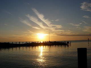
The third bridge on the Bay is on the far east end and is called the 331 State Road Bridge. After we go under it (65 feet), we look for a mooring on the Gulf Side. We stop about 2 miles from the ICW canal in the lake because we are not sure from our map if it is deep enough on the side of the canal to moor during the night. We check the Tides Chart and find that the water level may drop as much as two feet. We have traveled 56 miles today in 8 1/4 hours. The sunset is very colorful as we enjoy our Red Beans and Rice with salad dinner.


pic 1075


Tuesday, November 25, 2008

INTERCOASTAL WATERWAY November 25, 2008

After a full day Monday, the courtesy car at East Shore become available for a trip to town. After a quick shower, we headed for the Market on the Bay Restaurant, which we discovered closes at 2 p.m. on Monday. We found a restaurant that was open for dinner and then headed home. As we drove into the Marina, it started to rain. By the time we got inside Catrina, it was pouring. A half bucket of water came in the back door probably because the battens were so long we had to stick the ends outside. We did not get the main sail on yesterday as planned and used the darkness and rain as an excuse. When we hopped in bed, we found that a porthole had been cracked, not tightly closed, and the bottom of our bed was very moist. It was a very hard downpour!
This morning we had the main sail on by 7:30 a.m. and headed out into Mobile Bay. The Intercoastal Waterway leaves the East side Mobile Bay 18 miles below the Marina. We decided to sail just to get the kinks out of everything we may be put together backwards. Four hours later we reached the ICW and clocked our morning travel at 4.5 mph. Slow but peaceful!


The ICW connects lakes, rivers and canals so that boaters can travel inland but close to the Gulf. Along the passage are openings to the Gulf. We found the ICW to be very picturesque.


We saw white sand and beach houses and lots of docks and Marinas. We passed as many sailboats as barges. One sailboat reached Debbie on the radio and chatted about our trip. Since much of the inland lakes and rivers are very shallow, we had to be careful to stay in the marked ICW. When the markers are far apart, we know the channel is deeper or wider but when they are close together, we know we must stay right in the center!


We saw unsettled land and a variety of houses along the shores.


We covered about 50 miles to Pensacola FL in 10 ½ hours. We could see the buildings of Pensacola but chose to moor in the shallows at English Navy Cove beside the 292 bridge in Pensacola Bay.

Note: The sunset is behind us. We are at last headed EAST! and we are back in Verizon territory -we again have internet and phone!

Monday, November 24, 2008

EAST SHORE MAST RAISING November 24, 2008


Another day, our fourth, at East Shore Marina. Our appointment to get mast raised was at 8 and by 9 the crane had been repaired. As the comedy of errors continued, a part flew off the mast as it was just being raised out of the craddle. We got the mast up and found that the part secured the forestay to the mast and it was vital to sailing. Tom donned his scuba gear and began hunting. Believe it or not in very mucky water up to his neck, he found it. We spent another $50 getting the mast raised 5 inches. Then we put a nut (as in bolt) on a thin line, lowered it through the hole, grabbed it at the mast bottom and attached the found part. I don't know how it happened but the part did not get stuck in the five feet of mast it traversed and came through the hole right end up! We returned to our berth at East Shore and collapsed!


Water, sandwiches and a quick nap got us out on deck again. Do you know it is a lot easier to take a boat apart than to put to back together again. We found we need both heads to remember how it was. We got the furling sail up and started on the main, the jacks and the vang. After trying many different combinations of pulleys and lines we think we have it functioning. We decided to wait to put the main (sail) on until tomorrow or later tonight when it is not so windy. For now it is a shower and out to dinner!

Sunday, November 23, 2008

EAST SHORE MARINA November 22-23, 2008


It is a weekend of work: getting blog up to date, cleaning Catrina in and out, taking all the tie down lines off the mast and boom, refilling the propane, washing clothes, shopping, finding the sails and lines and getting the mast up on Monday Morning early!

MOBILE EAST SHORE November 21, 2008


Catrina has lot of miles to cover today because it is 64 miles to Mobile and our marina is 15 miles further toward the Gulf. We beat the sun up and were on the river before 6:30! We must be getting used to the cold as the inside was 45 degrees and who know how cold it was outside. However, there was no ice!


Debbie even remembered to take a picture of Three Rivers Lake Mooring in the predawn light!


With the tide going out (downriver) and the wind from the North (usually behind us) we make 8.4 mph and pass the junction of the Alabama River in 2 ¼ hours (8:45 a.m.)


Please notice the colors on the sign post. Green for the AL flowing into the Black Warrier/Tombigbee and Red for the upper river (away from port) of the main river. At this point the River is also called the Mobile River. That seems appropriate!

At this point the Mobile River is a lot wider. We spend a lot of time going with the current from side to side on each curve. Not often are we headed south with the sun on our left but I guess the river knows where it is going. Let’s hope!


When the Tensas River junctions at mile 39.3, the Mobile River gets narrower. It did not look like water was leaving to go to the Tensas. We will have to check this out. There wasn’t a marker post at the junction.


At mile 30 we come around a bend and are passed by a steel hulled two masted sailboat. He looks like he is going rapidly but the truth is we are the one moving quickly and he is motoring upriver!

We pass a swinging railroad bridge. This time we did not have to ask. They saw us coming and open the bridge!


Tom make good use of the sunlight to go over the lines that run up the mast. He changes the hook-in line for the TV set. The windvane and radar are good.

At 11:30 a.m, mile 20,we passed under the I-65 bridge. In three miles the shore changed to bayou country with grass, small palms and mangrove trees. From here on there are a number of small waterways back into the bayou.

When we reach the Big Bayou Canot Junction at Mile 9.8, we asked a passing pusher to make sure we took the correct route of three. He said two would work but of those one was pretty shoaled in. We took the one the barges use and passed a number of them. One of the barges was Kirby’s Antigone. We have passed it each day for the last two and this makes the third time. So I took a picture of it.


We reached Mobile at 2 p.m. It is a working town and the river is cluttered with boats of all types. On the north shore is their Convention Center and behind it Government Street and a few high rises.


Toward the gulf are the cruise ships. We passed a very large Norwegian Lines Ship.


Catrina cruised on by and 3 miles into the Gulf. It is windy here, very brisk with white caps. Next we turned east and headed for the Eastern Shore on a rolling broad reach and our home for the next three days. You guessed it - East Shore Marina!