Saturday, November 22, 2008

DEMOPOLIS November 18, 2008


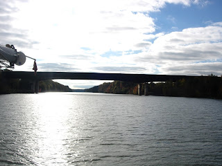
Last evening our locking friends stopped about two miles up river from us. We had Sumpter Recreation Area (above) Mile 269.9 to ourselves. We set the alarm for 6 but found that getting up was not so easy. We did not have ice on the outside of Catrina like yesterday morning but we also did not have electric to run our furnace last night. We had warmed the bedroom up with our ceramic heater before hopping into bed but by morning it was so chilly! Debbie had to shake Tom to make him get up. The sun as we left our secret hideway was just visible.


Nights are usually in the low 30's and days windy and (hopefully) not rainy with temps in the high 50's or low 60's. It is the wind and humidity that makes it so cold. Some people ask how we keep warm. Debbie layers clothing with warm socks, shoes, underwear and sometimes a tank top, tops and bottoms of long underwear, slacks, polar fur pullover or sweatshirt, wind and water proof pants, zippered polar fur, jacket with lining and hood and cap and mittens. Tom wears slacks, long sleeved shirt, jacket and hat. Our testerone levels are different! Debbie also gets up at least 5 minutes earlier than Tom just to get all the layers in place!


We continue to see green lily-like vegetation along the shores and floating in the river


I mentioned earlier that the air/heat furnace works off electricity. We can run the generator and use the furnace but so far we have used our little hearter sporadically and only in the bedroom to keep the boat warm. At night Debbie wears a long nightgown, jacket, slacks and socks. She has a hat and mittens if needed. Tom sleeps nude but sometimes wears a hat or hides under the covers so all you see is a lump! We have heard that opposites attract!

As we pull out of Sumpter, a barge psses us. With only three miles to go we did not even try to pass him. We knew the pusher would have already called in and gets preference at Heflin Lock. We drop anchor up river of the lock and wait. Soon three boats from yesterday and a new one join us. They are all headed for Demopolis yacht Basin.


Low sand cliffs and walls of light, crumbly rock appear along the river but most of the time it is scrub and trees. The leaves are brown or gone. Rarely is there any sign of human beings. We knew cell or internet reception was spacy and so is the population!


We were on the river by 6:30 and after many hours we departed the Heflin Lock at 9 a.m. This was much slower than we anticipated. If we thought it would take 2 1/2 hours to go three miles, some of us would have stayed in bed! The trawlers took off and we wandered along the curves at 8 mph.


The Cliffs of Epes were a wonder surprise, Mile 248.8. We will have to locate a native and ask what the type of rock is in these Cliffs.


The last 32 miles we passed a couple barges and enjoyed the countryside.

Demopolis Yacht Basin is an older marina with many different types and vintage of boats. One older building contained the shower and wireless, another a marine store, mast raising facilities ($400 plus labor) and a fuel station. We were the last of five boats to arrive so we got the bitter end spot on the end of a far out dock. A neighboring boater grabbed our line and asked if we knew about the underwater cables. No one told us and we hooked one with a rudder or motor. Fortunately, Tom was going very slowly so we did not sever it. We talked to the head maintenance man Fred. He promised to help us get out tomorrow. He also lent us the maintenance truck to run to town. We ate at Farmhouse Restaurant - a buffet of overcooked food. Showers next. We only had one key so we shared. Tom watched TV after dinner while Debbie went to the wireless shower building to work on this blog. Our boat was too far away to pick up their wireless.

We closed up for the coldest night yet. We were happy to have electric so we could run the furnace!

THE RIVER SECTION November 17, 2008

Look Carefully and you will see a boat in the fog!

We are up at 6 am and tom calls the Stennis Lock Mile 335 and learns that everything is on hold because of Fog! Finally just before 7 am three of the loopers from our Marina start out. We follow along and a fifth boat joins us. We lock through and the other four boats take off with us as caboose. We are traveling between 7 and 8 miles per hour.
Tom yelled, "Get your camera. There is a deer in the River! "


At 9:30 am we enter our last state before Florida - ALABAMA. We are 314 miles from Mobile. This is a sparsely populated area with little or no internet accesses. So that is why we are a week behind in posting.
At 10 a.m. we see a Tristar sailing down the river in front of us! What a surpise. We chat with the Skipper Jim and discover he is headed for the Altantic Coast of Florida also through the inland canal and plans to stop in Crystal River to see the Manatees. We give him our number and name.
Along the river we pass through fields of floating lily type water plants. We saw a large clump in the lock yesterday. Today they litter the river. Some were in 18 feet of water so we know they can exist without having roots in sand or soil.


This is a very nice trailer park with a rock lined shore.


Adjacent to the Bevill Lock (named for a Lock Master) was the US Snagboat Montgomery, the last steam-powered sternwheeler in the southern inland waterways. She was used for six decades until retired in 1982 and put on display at the Tom Bevill Visitors Center.


Before entering the Bevill Lock, six boats had an hour wait. We followed a barge down to the lock and were unable to pass it. We get second preference to barges on locks. Following are pictures of some of the boats we shared the lock with.


All day we have been in the RIVER SECTION of the Tombigbee Waterway which runs from Mile 366 to 217 at the junction of the Black Warrior River. To creat this section a channel 9 feet deep and 300 feet wide was dredged. More that 30 cutoffs were constructed to eliminate many severe bends. Not all bends were eliminated and during the greater part of the day we navigated around river curves, some as sharp as 90 degrees and other a 325 degree turn! Stay tuned tomorrow for a look at some of these curves!


We keep the throttle forward and make it to Sumpter Recreation Area Mile 270 about 5 p.m or dark. We have traveled for 10 hours and covered 65 miles including two locks, one deer and lots of barges. Sumpter Recreation Area is in a small lagoon. We drop anchor in the middle and hope it will not get too cold tonight! Maybe tomorrow morning we can get an picture of this area.

Friday, November 21, 2008

THE CANAL SECTION November 16,2008

The alarm was set for 7 a.m. as we planned a 36 mile short day to Aberdeen Marina, Mile 358. Of course, we woke up early! Four other boats from the Midway Marina left at 7 a.m. and we followed right behind them the short distance along the bay to Fulton Lock, Mile 391.


As we leave Midway we see too many Coots to count feeding on the marine vegetation along the shore.


This is the Canal Section (also know as the Chain of Lakes Section) runs from Mile 419 to 366. It is 52 miles long and consists of dams and pools connected to form a 9 foot deep waterway. There are five locks and dams in this section and we are doing the Locks 3-4-5 today. The locks are relatively chose and the traffic flow is coordinated. All locks were built about the same time, they look alike and all have the bollard system for tie ons. Because of the short drop, travel goes quickly. Each lock has a different VHF call number to eliminate reaching an unwanted lock.


As the five loopers leave the lock there is a barge down river ready to enter. When exiting a lock the water is very swirlly due to boat wakes and exiting lock water. We are the slowest boat and take the last position thus getting the most turbulence.


When the Waterway was constructed, the trees in the middle but not at the sides of the canal were cut. We see many stumps at the shores.


At Mile 376 we pass the Wilkins Lock. It has a 25 foot drop, the smallest drop yet in this section.


Above is a picture of floating marine growth in the Amory Lock, Mile 371. It seems to live whether attached to sand or floating and was probably what the Coots were feeding upon. As we leave Amory Lock, here is what we see.


Ox Bows were created when the river was "straightened". A canal was cut across a twist in the river making the channel straighter and creating a island. Behind the island is a quiet channel which makes a good overnight anchorage. Enter slowly and keep a close eye on the depth finder as some of these channels are shallow!


In this section the banks are much lower and covered with trees, scrub and sand.


Since it is only 1 pm when we reach Aberdeen Marina, we decide to continue down the river. We pass through the Aberdeen Lock and Dam at Mile 358 and head for Columbus Marina at Mile 335. If we hurry, we can reach the Marina by 5 p.m. when the sun disappears! We call and tell them we are coming and will need gas. Two of the loopers we traveled with earlier, Cynthia Faye and Baby Grand, have told us that this is a first class marina and extremely helpful.


A few miles before the Marina we come around a bend and see a sailboat! It cannot be more than 15 feet long. We speak with the man at the tiller as he putts putts along. He is on the way to the east coast of Florida via the Cross Florida Waterway but today he is headed for Columbus Marina!


As we near the marina, we can see the Stennis Lock and Dam but no Marina. Finally we see a sign that guides us to the left. We enjoy our short stay getting both gas and a shower. We opt for staying aboard and the "Cook" prepares Mashed Potatoes-Sauerkraut-Chicken.


Tuesday, November 18, 2008

THE DIVIDE CUT November 15, 2008

Returning last night from Frankie J's Restaurant and the Grocery, it began to rain. While Debbie did the laundry, it increased and continued all night. The rain on the roof top sounded like rain on a tent but our sides were not wet nylon! It felt good to get in our warm bed and snuggle.


All to soon the alarm rang. We quickly got dressed for another great day. Did someone forget to turn on the sun? The air outside and in was thick enough to cut and it was misting outside. When it rains, the water drops periodically clean off the window. When it mists, we have to wipe them frequently. So as we continued down the Yellow Creek to the Tenn-Tom Waterway and for the first 3 hours from 7-10 we wiped windows inside and out. Tom even tried a fan on the inside of the window to keep it from fogging up! It did not work!


The Tenn-Tom connects the Tennessee River at Pickwick Lake with the Tombigbee River at Demopholis AL. Below Demopolis it is called the Black Warrior-Tombigbee Waterway. Construction on the Waterway began in 1972 but was not completed until June of 1985. More earth was moved in this project than for the Panama Canal! It shortened the trip by as much as 720 miles. A vessel going from Pensacola FL to Chattanooga TN would travel 771 miles rather than 1,541 via the Mississippi River .


The Waterway runs downhill 341 feet over 450 miles from Pickwick Lake to Mobile. We are back on green for RBD and red for LBD. The Waterway is divided into three sections. Today we entered the 27 mile "DIVIDE CUT" which ends at mile 441.9 and the Whitten Lock, our first lock of the day. It connects the Tennessee and Tombigbee River basins and is 280 feet wide and 12 feet deep. Along this stretch we passed one barge 2 x 2 and one pleasure boat passed us! Also in the Divide Cut we passed into the state of Mississippi .


The next 52 miles is the "CANAL SECTION", which consists of dams and pools. It contains 6 locks and dams. We will cover 20 miles of the Canal Section today and the rest tomorrow. The Divide Cut is separated from the Canal Section by the Whitten Lock and Dam (above). It is the third highest lock east of the Mississippi and the fourth highest in the nation. The drop is 84 feet.


It took us an hour to clear Whitten Lock. We waited about twenty minutes for the lock to filled, went in, tied up and then slowly descended as the water was let out. Looking up a bollard really gives you a feeling of the depth inside.


The final lock of the day was Rankin, also with a 30 foot drop.


Compare the depth of Whitten (picture before) with Rankin (below).


Our home for the night is Midway Marina, four miles further down the river and the halfway point on the Canal Section. We finish the day at 56 miles including 3 locks in 8 1/2 hours. After gassing up (we are getting almost 6 mpg with both engines at 3,000 rpms), we borrowed the loaner car and visited Walmart for an extension cord to put a light in our fresh water pontoon. Dinner at Wendy's. It is predicted to be 20 degrees tonight? We are glad to be on the downhill river flowing into the warm weather gulf!


Monday, November 17, 2008

PICKWICK LAKE November 14, 2008

Outside our windows the trees were covered with fog. Not dense but wet. As Debbie wiped down the windows, both sides, Tom started the motors. He started each again. Neither motor would start! We had plenty of gas but they just wouldn't turn over. Here we are out in the middle of Tenneesse with no motors with the trailer camp which looks unoccupied our nearest neighbors a mile up river. Now any wise person would have a good solution. Debbie made breakfast and Tom took the cover off the motor and tinkered around. After a long while it started. When asked what was wrong, Tom said, "I have no idea but it works no

After that tiring experience, Tom went to the office (above). Note the GPS and autopilot along side the maps on the first mate's side. When it is humid, she spend lots of time wiping the inside and outside of the windows while Tom catches a nap!


It is not a dream that the along the shore there are often high bluffs. The houses had great views.


You might call this one a high cliff house.


Note the little shed with the chimney half way up the hill. There are extensive stairs to climb and the hill has been planted, probably with grass and covered with a sheet. We speculated that this was either a get away one room shack, a river halfway house or the servants quarters for a larger spread up the hill.


We traveled with two motors running and made at least 6 mph. This is what we usually make with one motor but today the water is being let out of the Pickwick Dam giving us a current to slow us down.
Pickwick Lock is our second one on the second half of our trip and our sixteenth lock of the trip. The newer locks have two chambers and we, a single small boat, are sent to the larger one. We feel very small during the 53 foot drop. The prior lock on the other side of Kentucky Lake had a 57 foot drop. All newer locks also have bollards. Debbie has the line wrapped around the bollard with one end attached to the cleat and the other under the cleat end and held firmly by both hands. If she lets go, the boat will be free and can bounce off other boats or lock walls.


After the lock we entered Pickwick Lake.


A few miles along is the turnoff for Yellow River. After 8 hours and 46 miles on the river, we arrive about 3 p.m. at Grand Harbor Marina. Friends further down the River stayed here and received a 10% discount as members of US Boat. We take advantage of this, gas up, get a well deserved shower (after 5 days with none), go out to dinner and grocery shop.


The real estate near our marina will tell you something about how classy this marina is. The manager is very helpful. We keep four other transient boats company tonight.